![]() A California-based ag imaging company is launching a new low-cost, high-quality on-demand imagery national service for farmers and crop consultants.
A California-based ag imaging company is launching a new low-cost, high-quality on-demand imagery national service for farmers and crop consultants.
The aerial program has been developed and tested in 2015 by Mavrx®, a global innovator in delivering on-demand and actionable agronomic information from aerial and space-based imaging. Already partnered with many of the industry’s leading service providers and growers, Mavrx will expand the availability of ultra-high-resolution imagery using 100 aircraft pilots and its proprietary technology.
Max Bruner, CEO of Mavrx explains why the company has made such a bold move into the air. “Rather than rely solely on satellite data, which often is obscured by clouds, and has low resolution, Mavrx has invested in developing a comprehensive system to use airplanes to capture and deliver ultra-high-resolution imagery that farmers and their advisors need, via the Mavrx app,” says Bruner. “The system streamlines the process for everyone. Images can be ordered directly through the app while in the field and we take it from there. Our pilots fly the targeted fields, can cover a vast amount of land, and within 24 to 72 hours after acquisition, growers see their requested multi-spectral images and analyzed crop performance for each field flown.”
Take a look at this example:
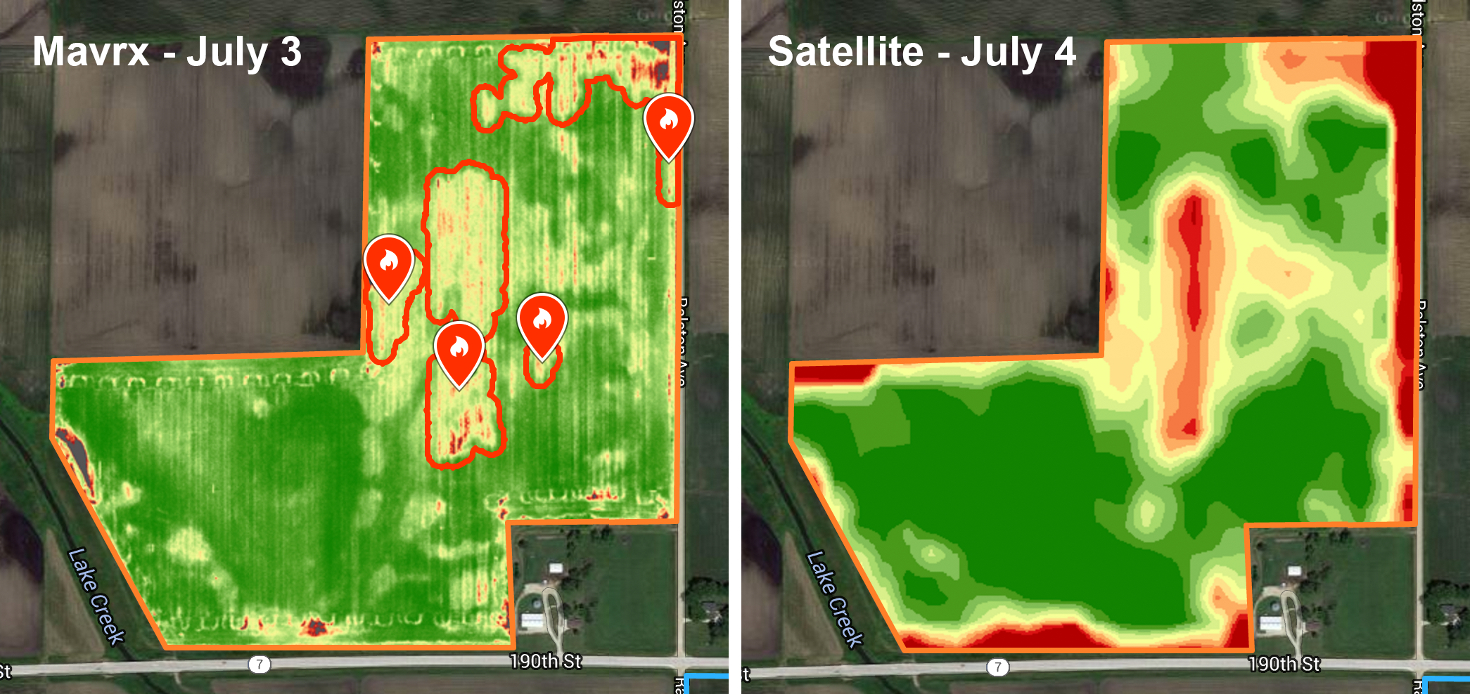
Mavrx ultra-high-resolution imagery from aircraft reveal deeper insights into field conditions than low-resolution data from satellites. For example, you can see the rows in the field and patterns made by farm equipment. Mavrx Scout uses these ultra-high-resolution images and Mavrx algorithms to send alerts to the farmer and his agronomist showing areas that require attention with greater accuracy and reliability than before.
To learn more, visit mavrx.co.